About District
❖ Ariyalur District is located in central Tamil Nadu and is 265 Km away from Chennai, located between 10° 54’ 00” and 11° 26’ 00” degree Northern latitude and 78° 56’ 00” and 79° 31’ 00” degree of Eastern longitude. The District has an area of 1949 Sq.Km. It is an inland district without any coastal line. The District has Vellar River in the North and Kollidam River in the South, and the Marudaiyar River flows through the district and joins the Cauvery River. The District has no well-marked natural divisions.
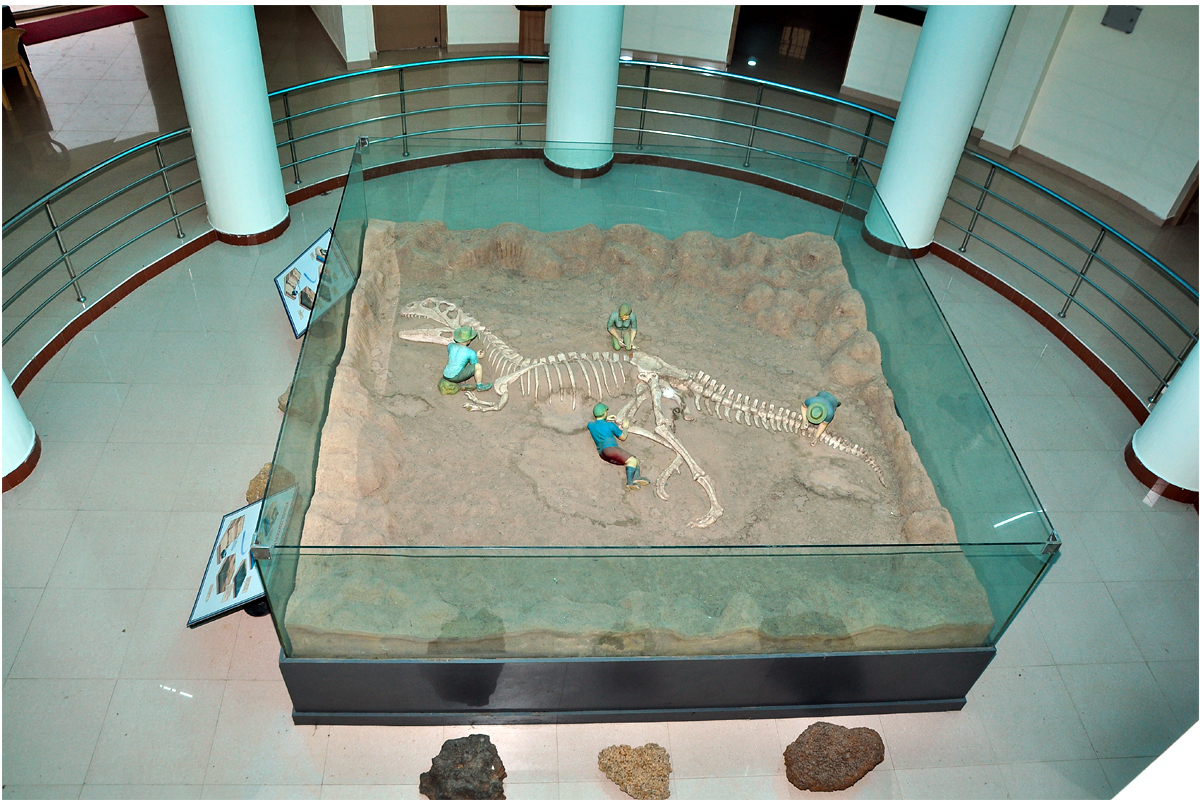
❖ Ariyalur was once submerged under the sea, but the sea receded around 15 million years ago, creating the land that is now the district. Ariyalur is known for its rich prehistoric fossils, including those of gigantic molluscus, jawed fishes, and the Indian dinosaur genus Rajasaurus. Hence, the district is known as a “Palaeo-Zoological Garden” because of the many fossils found there, including dinosaur eggs.
Company Statistics Analysis
Great Achievement For Insurance
8563 +
Saticfied Custimer
2630 +
Experience Members
100 %
Satisfaction Rate
25 +
Years Experience
963 +
Awards Winning
Popular Clients
We’ve 1520+ Global Premium Clients


❖ Ariyalur District is rich in mineral deposits such as Limestone, Lime kankar, Sandstone, Shale, Clay, and Phosphate nodules, which occur at various places. Limestone of sedimentary origin has been found in Ariyalur and Sendurai Taluks. The Limestone is cement grade to plus cement grade in quality and is used in cement plants. Fire Clay is used for manufacturing floor tiles, stoneware pipes, fire bricks, and in the chemical industry. Jayamkondam in Udayarpalayam Taluk is rich in Lignite, Oil, and Gas reserves. Apart from the above major minerals, common-use minor minerals such as Red Gravel and filling earth are also found in this District. The district is also home to the Gangaikonda Cholapuram, a UNESCO World Heritage site built by King Rajendra Cholan of the Chola Empire.
❖ Canal, tank, tube well, and open well are the main sources of irrigation in this district. The major crops grown in the district are Paddy, Maize, Cotton, Groundnut, and Sugarcane.
❖ As per 2011 Census, the total Population of Ariyalur District is 7,54,894. The density of population in the district is 389 per Sq.Km.
❖ Ariyalur District came into existence by the bifurcation of Perambalur District as per G.O.(Ms) No.683 Revenue (RA1(1)) Department dated 19.11.2007. It is bounded on the North by Cuddalore, South by Thanjavur, East by Cuddalore and Thanjavur, and West by Perambalur and Tiruchirapalli districts. Ariyalur has been functioning as a separate District since 23.11.2007.
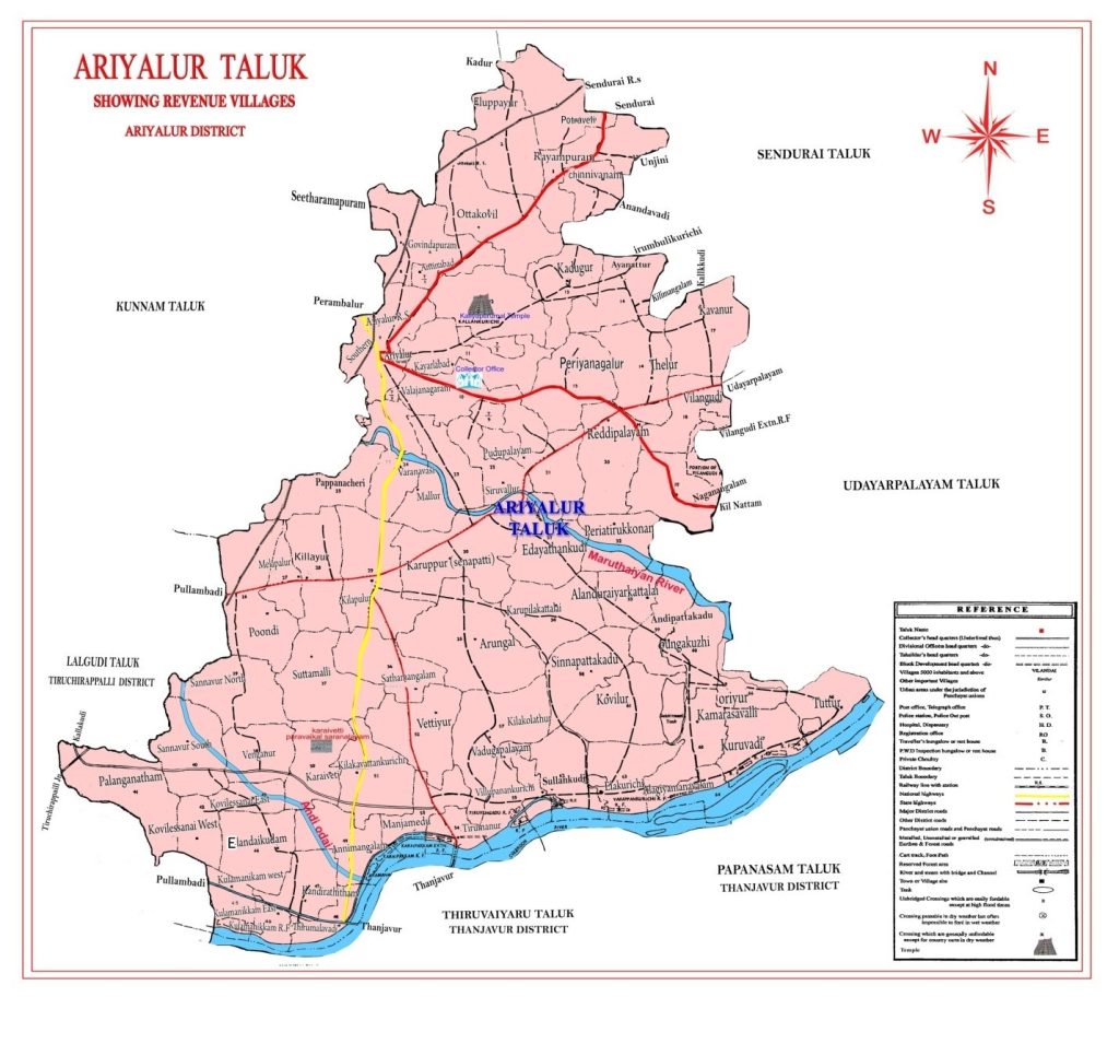
❖ Ariyalur District consists of two Revenue Divisions viz., Ariyalur and Udayarpalayam, Four Taluks viz., Ariyalur, Sendurai, Udayarpalayam, and Andimadam (Andimadam Taluk is formed as per G.O.(Ms) No. 167 Revenue (RA1(1)) Department dated: 08-05-2017) comprising 195 Revenue Villages. The District has six blocks viz., Ariyalur, Thirumanur, Sendurai, Jayankondam, Andimadam, and T.Palur comprising 201 Village Panchayats. There are two Municipalities viz., Ariyalur and Jayankondam, and two Town Panchayats viz., Udayarpalayam and Varadharajanpettai.